
When Charis Duthie moved to Johnshaven with her husband in 1984, she could cycle along the coastal path out of the village. Now, she meets a dead end where the sea has snatched the land and is instead greeted with a big red warning sign of what is to come: Danger Coastal Erosion.
“You can see gardens that were there and now they’re gone,” she says.
The north-east coast of Scotland is experiencing a rapidly worsening erosion problem that will only be exacerbated by recurrent patterns of extreme weather and rising sea levels.
Johnshaven, a small village with a close-knit community of 640 people about 30 miles (48km) south of Aberdeen, is particularly exposed.
The village’s paths bear the scars of coastal erosion in the form of craters in the well-trodden rock, while some, such as the one Duthie points to, have disappeared altogether. The latest was taken from the village in 2023 during one of the many extreme storms that winter.
Finding a solution to the problem has taken on an urgency like never before. Three years ago came the announcement of the Platinum Jubilee Path, named in honour of Queen Elizabeth II’s 70 years on the throne. The aim is for it to start in St Cyrus, four miles south of Johnshaven, and end about 90 miles further north in Cullen, a village with close associations to Robert the Bruce.
-
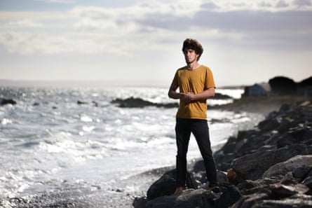
Johnshaven, on Scotland’s North Sea coast, will attract more visitors if it has a well maintained coastal path
With the markets that have traditionally fuelled its economy – fishing and oil and gas – dwindling, Johnshaven wants to attract more visitors through the coastal path plans. The aim is to be part of Scotland’s Great Trails, which offers a map of named, walkable trails around Scotland. Currently, there is a gap in the map along the north-east coast between Aberdeen and Dundee, and Johnshaven sits in the middle of it.
For Duthie, 71, helping to fill this gap is an increasingly daunting task. She is part of a small team called the Mearns Coastal Heritage Trail (Merchat) who work to restore and create coastal paths in Aberdeenshire. But as they work in one area, the sea snatches land away in another.
“A lot of what we are trying to do is to prevent erosion with rock armour, which is really the only secure method,” she says.
Rock armour, sometimes known as riprap, is made up of big boulders and rocks placed along the coastline to protect against the waves.
-
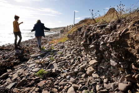
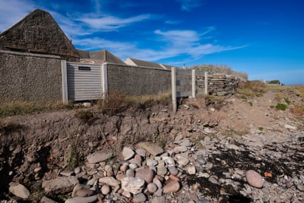
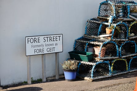
Clear signs of coastal erosion in Johnshaven, top and above left. Creels in the street reflect the village’s fishing heritage
To complete areas of the trail, Merchat has had to gain funding through grant applications. The food ingredients firm Macphie has donated £30,000, and a further £40,000 has come from Aberdeenshire council’s allocation of crown estate Scotland cash from the Coastal Communities Fund, money allocated by the government to help coastal communities “flourish and strengthen their appeal as places to live, work and visit”.
Caspar Lampkin, project officer for the Aberdeenshire coastal paths on Benholm and Johnshaven community council, says further help from Aberdeenshire council is likely to be minimal. “They’ve told us that they don’t have the resources to do anything,” he says.
“If small villages want anything like this to happen, it has got to be locally led, because we’re not going to get much help from the government or the local council.”
-
Caspar Lampkin, the community council’s project officer for coastal paths, is trying to secure funding to help counter erosion
Since April, Duthie, Lampkin and the Merchat team have been working to establish a way to apply for designated funding. “We have now started a charity called the North East Scotland Coastal Trust [Nescat] and we are paddling very fast to get the whole thing established and get going with it,” says Duthie.
Meanwhile, another issue beyond access to the beautiful scenery is becoming increasingly urgent, says Lampkin. The community council has identified 100 houses in the village at risk of flooding from the sea in the coming years if no action is taken on erosion.
While the focus of the team’s work is meant to be on restoring the paths, he says that any funding they get will probably need to be used on rock armour in areas that could protect housing along the path.
Angie Dunsire, 74, walks no more than 10 steps from her doorstep before reaching the eroding coast.
She has lived in Johnshaven for 32 years on the aptly named Beach Road. She says she gets a call from the Scottish Environmental Protection Agency every time there is a risk of flooding.
As Storm Floris approached in August, they called. “You have to be careful and listen,” she says. “We had a little bit [of water] in [the house] the other day because if it’s a high tide, it’s stormy and there’s wind, those elements blow it in.”
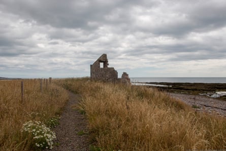
Dunsire is scared of what the North Sea is capable of. In the distance there is a reminder. Sitting only three miles from Johnshaven is Miltonhaven – or what is left of it.
It is reported by Duncan Fraser, in the book Portrait of a Parish, written in the 1970s about the parish of St Cyrus, that Miltonhaven was taken by the North Sea after Robert Scott of Dunninald arrived in the village in the 1700s.
-
The remains of the ‘lost’ village of Miltonhaven, once a bustling coastal community populated by smugglers, lime workers and fishers. Photograph: Andrew Diack/geograph.org.uk
“What first drew his attention was the limestone rock that stretched in a reef across the bay, like a natural breakwater guarding the little village from the angry sea,” writes Fraser.
Scott was from a family that built lime kilns to produce fertiliser for fields. From about 1750 Scott removed most of this limestone rock for his business, so the story goes, leaving the village exposed.
By the 1790s, Fraser wrote, the waves had taken the “entire village”, which now lies underwater 100 yards from the shore.
In an effort to right some of those so easily visible wrongs from the past, the stretch of path along Johnshaven’s Beach Road will be the first focus for rock armour with any funding the community can muster. But rock armour is expensive – about £1,000 for a small truckload – so it’s likely there won’t be much left over for path building.
“People say, well it’s just your houses why go to all this expense?” says Dunsire. “Well it’s not just our houses it’s the road that goes right through the village to the park and further on.
“We’re supposed to be using the coastal path and extending that. What is the point if this [the land and road along the coast] goes?”
A Scottish government spokesperson says it has provided local authorities with £11.7m to support coastal change adaptation, while Aberdeenshire council says its overall budget for coast protection is £75,000 and there are no plans for any new protection works in Johnshaven. It says support and advice has been given in the setting up of Nescat and that it is not aware of any issues with the part of Beach Road that is council owned.
-
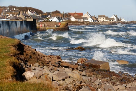
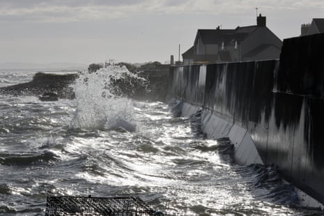
North Sea waves batter sea defences at Johnshaven. Local activists have seen coastal erosion getting worse over recent decades